Our first stop in Banff was the Whyte
Museum of the Canadian Rockies, located in downtown Banff.
Among the numerous items related to the Pavilion, the
Archive Department contained a major key. A 1916 survey by
C. M. Walker. The museum also contains some of the only
photographs that document the Pavilion.
There are different
report as to the exact location of the original Pavilion.
The Banff Crag and Canyon, December 16, 1964, places it at
the "site now occupied by the tennis courts..." Other
reports place it by the shelters.
The 1916 survey records
the curve in the Bow River, the Bridge, still crossing in
the same spot, Cave Avenue, the Boat Canal and Boat House,
and most |
|
importantly, the location
and positioning of the Pavilion, all at a scale of 150:1.
When superimposing it over an areal view from Google, at the
same proportion, we are able to locate the original site of
the Pavilion. From the center of the Pavilion, it measures
approximately 870 feet to the edge of the Bow River
and approximately the same distance to the center of Cave
Avenue.
With survey in hand, we
headed toward the recreational grounds. Not having the
opportunity to superimpose the survey over the areal view at
the time, we walked off the approximate measurements,
placing us in the eastern ball field, very close to the
original location. With photographs in hand we attempted to
replicate the views of the original images. |
|
|
 |
|
Courtesy of the Whyte Museum of the Canadian
Rockies. |
|
|
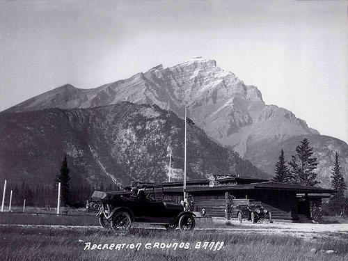
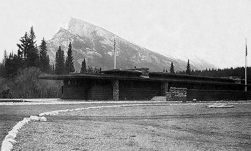
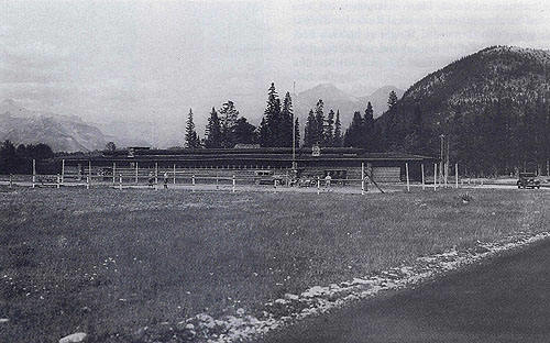
1: Looking toward the Southeast,
circa 1913.
Two of Mt. Rundles' peaks are visible in the background. The
roof is cantilevered around 14 feet at the corner. The end
of the pavilion is rotated 90 degrees, coming to a point.
Two of the fireplaces and the clerestory windows are visible,
as well as the broad stairs that lead up to the open terrace
that runs half the length of the building. The Ladies Retiring Room and Kitchen
are on the left, the interior Pavilion is on the right.
The drive does not appear on the survey. |
|
|
 |
|
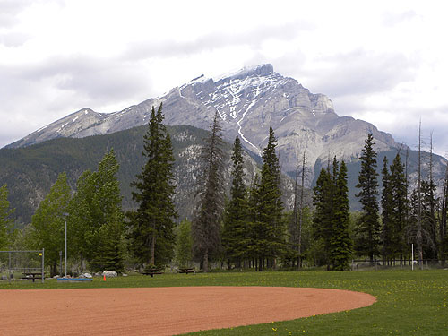
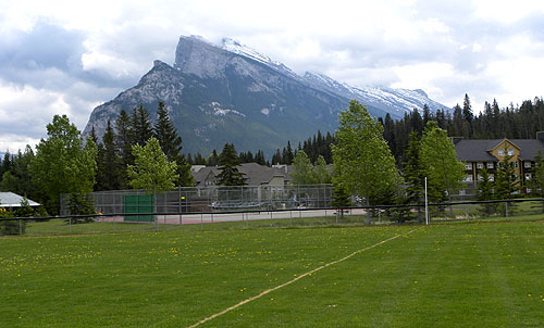
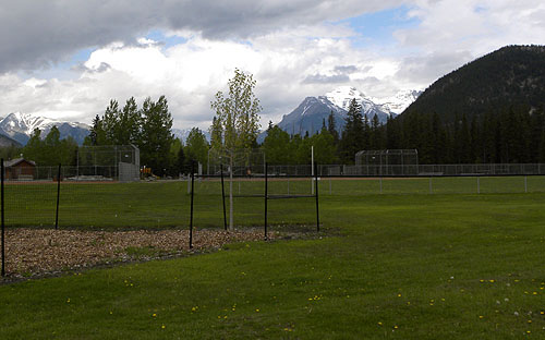
1b: Looking toward the
Southeast today. Mt. Rundles' peaks are visible in the
background. |
|
|
 |
|
Courtesy of the Public Archives of Canadian. |
|
|
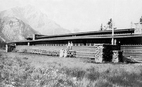
2: Looking toward the
Northeast. The Mt. Astley Range is in the background to the
center right with Tunnel Mountain on the right side. There were strong horizontal lines, the low-pitched
roof, broad overhanging eaves, horizontal rows of art-glass
windows and doors, three prominent fireplaces, clerestory
windows and terrace. The Ladies Retiring Room and Kitchen
are on the left, Men's Retiring Room and caretaker's room on
the right. The drive, from which this photograph was taken
does not appear on the survey. |
|
|
 |
|
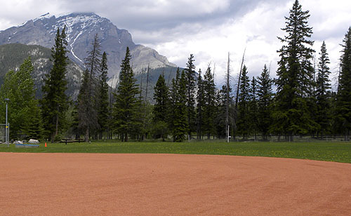
2b: Looking toward the
Northeast today. The Mt. Astley Range is in the background
to the center right with Tunnel Mountain on the right side. |
|
|
 |
|
Courtesy of the Whyte Museum of the Canadian
Rockies. |
|
|
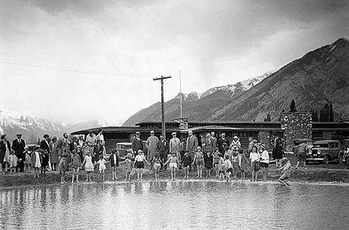
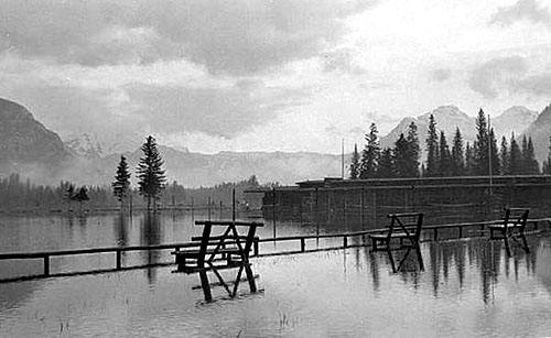
3: Looking toward the
Northeast, circa 1920. Stoney Squaw Mountain is to the far
left, the Mt. Astley Range is in the background on the
right. The Banff Craig and
Canyon, dated July 10, 1920 reported that "The
grounds in front of the recreation building were under water
last week, and it was possible for a man, if so inclined. to
wade out to the building, sit on the steps and fish."
This flood, as well as the severe flooding in 1933 caused
irreparable damage to the Pavilion, leading to its eventual
destruction. |
|
|
 |
|
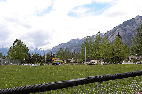
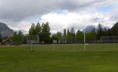
3b: Looking toward the
Northeast today. Stoney Squaw Mountain is to the far left,
the Mt. Astley Range is in the background on the right. |
|