|
We began our search by locating
the Boat Canal which begins approximately 800 feet from the
Banff Avenue Bridge. One side of the canal is still lined
with rocks. The Boat House was located approximately 250 feet from the
Bow River's edge. By rough calculation the dimensions of the
Boat House were approximately 50 x 60 feet. Interestingly,
about 300 feet from the edge of the river |
|
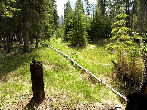
we located the remnants of
a pole. A corner post? An old power pole bringing
electricity to the Boat House? As we continued on down the canal
close to the ball fields and stables, there
was still standing water and areas that were very marshy.
Could this explain Image 7? |
|
|
 |
|
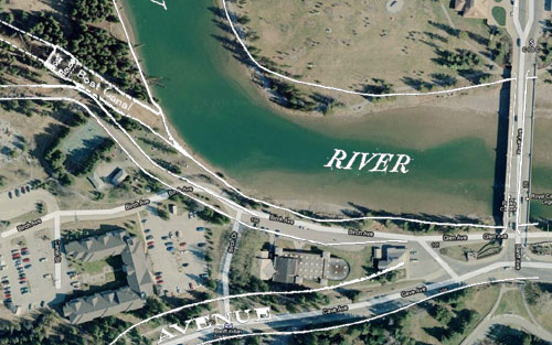
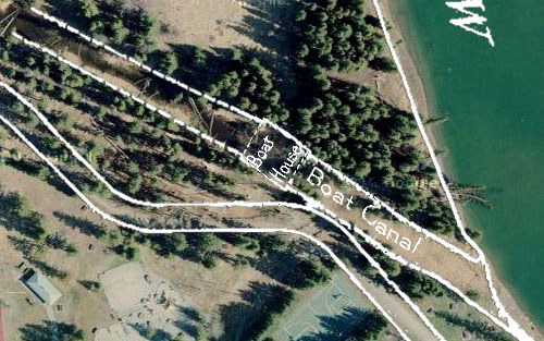
1: When superimposing
the survey over the areal view, we are able to
locate the original site of the Boat House and Canal,
approximately 800 feet from the Banff Avenue Bridge.
The
shallow Boat Canal leads to a Boat House, and continued on,
ending very close to the original site of the
Pavilion. Could this Canal have increased the flooding in
the immediate vicinity of the Pavilion, eventually
accelerating its deterioration? |
|
|
 |
|
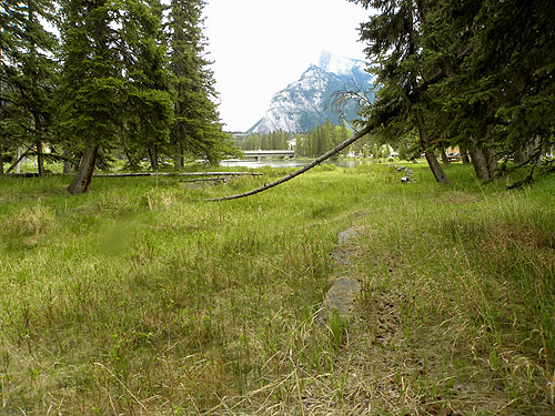
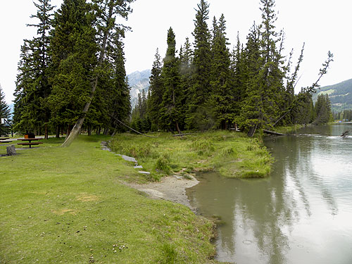
2: From the Boat Canal, looking
back toward the Banff Avenue Bridge. |
|
|
 |
|
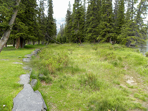
3: Detail of the
existing Boat Canal and site of the original Boat
House. The original road leading to the Pavilion
from the bridge has been abandoned. |
|
|
 |
|
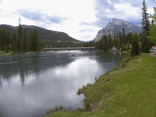
4: The Boat Canal is located approximately 800 feet from the
Banff Avenue Bridge. The rocks lining the left side of the canal
are still visible. |
|
|
 |
|
5: The rocks lining the left side of the canal
are still visible. Looking up the Canal toward the Boat
House which was located approximately 250 feet from the Bow
River's edge. |
|
|
|