SUPPORT THE
WRIGHT LIBRARY
PROCEEDS FROM EVERY SALE GOES TO SUPPORT THE WRIGHT LIBRARY.
CLICK TO ORDER.
WE PROUDLY SUPPORT THE FRANK LLOYD WRIGHT FOUNDATION

WE PROUDLY SUPPORT THE FRANK LLOYD WRIGHT BUILDING CONSERVANCY
WE PROUDLY SUPPORT FALLINGWATER
AND THE WESTERN PENNSYLVANIA CONSERVANCY

MONTANA
BITTER ROOT INN STUDY COMO ORCHARD SUMMER COLONY STUDY LOCKRIDGE MEDICAL CLINIC
CHICAGO ALUMNI MAGAZINE MONTANA MAGAZINE WESTERN HISTORY OVERLAND MONTHLY
Date: 1904 Title: The Iron and Steel Works of The United States 1904 (Compiled and Published by The American Iron & Steel Association, Philadelphia, PA. Sixteenth Edition, Printed by Allen, Lane & Scott, Philadelphia)
Author: American Iron & Steel
Description: Includes information concerning W. I. Moody, General Manager of the Muncie Works, American Rolling Mill Corporation, with offices in the Rookery Building (S.113), Chicago, Ill. Moody was involved in financing and promoting the Como Orchard Summer Colony, University Heights (S.144) and the Bitter Root Inn (S.145). (Digital copy) See Additional Information...
Pages: Pp 468
S#: 0055.02.1009
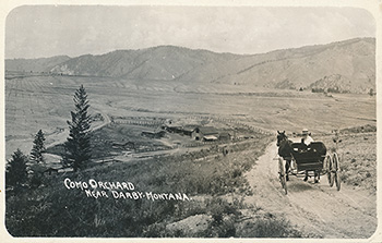
Date: Circa 1907
Title: Como Orchard Summer Colony, University Heights, Near Darby, Montana, Circa 1907 (1909 - S.144).
Description: Real Photo Post Card. View of the Como Orchard in it�s infancy. Rows of apple trees can be seen off into the distance. Frank Lloyd Wright designed the Como Orchard Summer Colony in 1909, and construction of the clubhouse began in May, 1909, and was completed by ealy 1910. It is not clear if this was the site for the Summer Colony, but the typography of the mountains in the background match those in �Clubhouse Circa 1929.�
Text on face: �Como Orchard, Near Darby, Montana.� A horse and buggy is stopped in the road and the driver is turtned around looking at the camera. Text on Verso: �Post Card. Correspondence Here. Name and Address Here.� Stamp box: Four triangles pointed upward in each corner.�AZO� is on all four sides between the triangles. �Place Stamp Here� is in the center of the box. AZO published these from 1904 - 1918. Real Photo Post Card. See Additional Information...
Size: 5.4 x 3.4
S#: 0080.80.0525Date: 1908 Title: Bitter Root Inn Remnant (1908 - S#145).
Description: Concrete foundation remnants from the Bitter Root Inn. Designed in 1908, the Inn opened in October of 1909. The "apple boom" was on in the Bitterroot Valley, Montana. Investors from the east were wined and dined. They were given free rail passage and transportation where they were lavishly entertained at the Bitter Root Inn. Lodging, dinner and golf were free. So was the French wine. The boom was short lived. Blight destroyed much of the valley�s crop in 1913. Law suits plagued the company. They filed for bankruptcy in 1916. It ceased as an inn, but was used as a dance hall and roadhouse. Finally on July 26, 1924, fire destroyed the Bitter Root Inn. See Additional Information...
Size: 5 x 6.5 x 2.25.
S#: 0085.06.0909
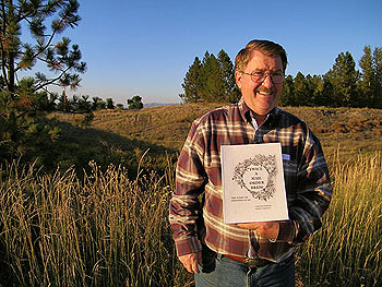
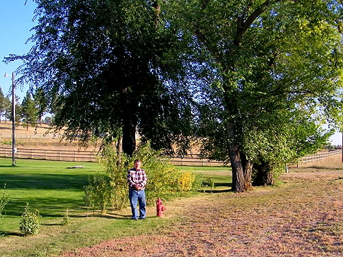
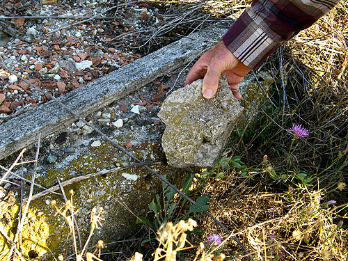
John Stroud hold a small piece of concrete next to a section of concrete at the site of the Bitter Root Inn, an artifact now added to our collection.Date: Circa 1908
Title: Bitter Root Valley, Montana Circa 1908.
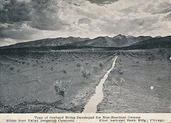
Description: View of an orchard in the Bitter Root Valley, Montana. Frank Lloyd Wright designed two projects for the Bitter Root Valley Irrigation Company. The Bitter Root Inn (1908), and the Como Orchard Summer Colony, University Heights (1909). They were two separate projects over forty miles apart. Chicago financiers W. I. Moody and Frederick D. Nichols (1906 - S.118) were early developers of the Bitter Root Valley. By 1904 Moody was General Manager of the Muncie Works, producing Iron and Steel as well as operating Natural Gas Wells. Their offices were in the Rookery Building in Chicago. Wright remodeled the Rookery in 1905 (S.113). Moody visited the Bitterroot Valley in 1905. By 1907 they had purchased and sub-divided large sections of the valley into 10 acre parcels for fruit orchard development. They paid $2.50-$15 per acre and resold "apple orchard tracts" at $400-$1,000 per acre. The company quickly became rich.
By 1909 three rail lines ran to Missoula, Montana, with a connecting spur to the Bitterroot Valley. Most likely because of Nichols� relationship with Wright and Moody�s knowledge of Wright, he was hired to design two developments. Como Orchard Summer Colony (S.144) and the Town of Bitter Root. In February 1909 Wright, Moody and Nichols visited the valley. Wright's first site plan for the Town of Bitter Root was rejected. His second proposal was a scaled down version which he called the Village of Bitter Root which included the Bitter Root Inn, the only structure built in the Village. It opened in October of 1909. Sales was aimed at the wealthy. The "apple boom" was on. Investors from the east were wined and dined. They were given free rail passage and transportation where they were lavishly entertained at the Bitter Root Inn. Lodging, dinner and golf were free. So was the French wine. The boom was short lived. Blight destroyed much of the valley�s crop in 1913. Law suits plagued the company. They filed for bankruptcy in 1916.
Text on the face: "Type of Orchard Being Developed for Non-Resident Owners. Bitter Root Valley Irrigation Company. First National Bank Bldg., Chicago." Text on verso: "The Valley of Opportunity. You may purchase a tract and have it scientifically developed to orchard, without leaving your present business. Bitter Root Valley Irrigation Company. First National Bank Building, Chicago." Note: This postcard was strictly used for promotion. The was only room for writing an address.
Size: 5 x 3.6
S#: 0085.52.0422Date: Circa 1910
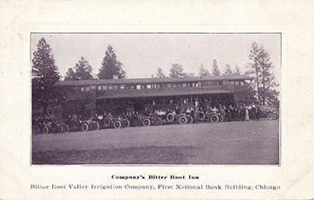
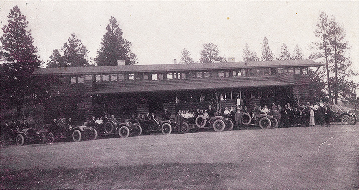
Title: Bitter Root Inn, Stevensville, Montana, Circa 1910 (1908 - S.145).
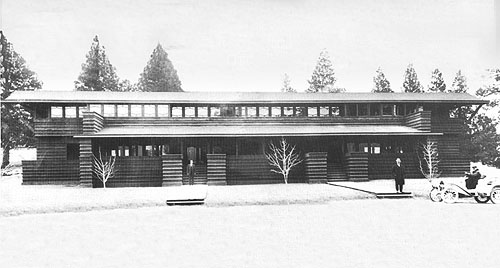
Description: View of the Bitter Root Inn from the West. Seven automobile and dozens of people stand in front of the Bitter Root Inn. There were many classic Prairie styled Wright details in the Bitter Root Inn. The basic material was wood, using board and batten siding and shingles for the roof. Strong horizontal lines, low-pitched roof, broad overhanging eaves, horizontal rows of leaded or mullion divided glass windows and glass doors, two prominent centrally located fireplaces and chimneys, balconies and porches. The Dining and Reception Rooms were designed with large semicircular fireplaces. There are built-in piers or columns that could have been designed for planters or large vases like many of his buildings at that time. The drawings for the unbuilt Office in Bitter Root did include large vases. The Inn was 126 feet long and two stories tall. The first floor included a Dining Room on the north, an office in the center, a Reception Room on the South, and a large Porch on either end. The wing behind the center office included a kitchen and two additional bedrooms. An open gallery ran the length of the front of the building. The second floor included 20 Bedrooms, Men�s and Women�s Baths in center and Balconies on either end. Running water and electricity included.
The boom was short lived. Blight destroyed much of the valley�s crop in 1913. Law suits plagued the company. They filed for bankruptcy in 1916. It ceased as an inn, but was used as a dance hall and roadhouse. Finally on July 26, 1924, fire destroyed the Bitter Root Inn.
Text on face: �Company�s Bitter Root Inn. Bitter Root Vally Irrigation Company, First National Bank Building, Chicago.� Text onb verso: �Post Card. This space for correspondence. This space for address only.� Postmarked: �Sep 20 1911.�
Size: 5.5 x 3.5.
S#: 0094.128.0425
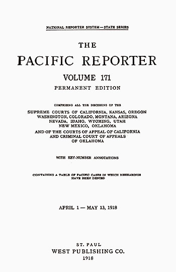
Date: 1918 Title: The Pacific Reporter, Volume 171 (Published by West Publishing Co., St. Paul)
Author: West Publishing Co.
Description: "Como Orchard Land Co. v. Markham." Pages 274-276. 6.25 x 10. Relates to the Como Orchard Summer Colony, University Heights (S.144) and the Bitter Root Inn (S.145). (Digital and Printed version.) See Additional Information...
Size:
Pages: Pp 1183
S#: 0139.04.1109
Date: 1929
Title: Como Orchard Summer Colony, University Heights, Near Darby, Montana, Circa 1929 (1909 - S.144).
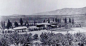
Description: View of the Como Orchard Summer Colony, designed by Frank Lloyd Wright in 1909. The Clubhouse is in the center of the photograph. To the left most likely is a barn erected for horses and storage for the orchards. Five cottages can be seen in the background on the left and the right. Fruit trees are visible as-far-as the eye can see. Text bottom right: "Johnsons '29 U-H-10." See Additional Information...
Size: 10 x 5 B&W copy photograph.
S#: 0228.40.0525Date: 1988 Title: National Register of Historic Places, Hamilton, Montana. Historic Resources of Hamilton, Montana. (Published by the United States Department of the Interior, National Park Service, Washington D.C.)
Author: Michels, Kirk
Description: Inventory - Nomination Form. History of Hamilton, Montana and the surrounding area. Includes historical information on the Big Ditch Development, the Bitterroot District Irrigation Co., and the two planned communities designed by Frank Lloyd Wright, which included "University Heights near Darby and the town of Bitterroot near Corvallis." See Additional Information...
Size: 8.5 x 11, Digital and printed version.
Pages: Pp 21
ST#: 1988.47.1009
Date: 1991 Title: National Register of Historic Places, Stevensville, Montana. Historic and Agricultural Resources of Stevensville, Montana. (Published by the United States Department of the Interior, National Park Service, Washington D.C.)
Author: Montana State Historical Preservation Office Staff
Description: Multiple Property Documentation Form. History of Stevensville, Montana and the surrounding area. Includes historical information on the "Apple Boom", the Big Ditch Development and the Bitterroot District Irrigation Co. "The new townsite of Bitterroot was platted just north of Stevensville, and the Bitterroot Inn, designed by Frank Lloyd Wright, was built in 1920 and served as an informal headquarters for the Chicago-based land developers and investors." See Additional Information...
Size: 8.5 x 11, Digital and printed version.
Pages: Pp 30
ST#: 1991.49.1009
Date: 1991 Title: Bitter Root Project (Published by The Department of the Interior, Bureau of Reclamation Records. National Archives and Records Administration, Denver, Colorado)
Author: Bridges, Kelly
Description: "Thousands of acres of newly irrigable land were purchased by newcomers. These newly settled lands became the subdivisions of East Side Addition, Hamilton Heights, ... and University Heights. Each of these divisions saw the construction of golf courses and large inns. Additionally, many of these divisions planted acres of McIntosh Apple orchards. Intense advertising to attract even more people to these lands occurred, boasting that land selling from $200 to $300 per acre could earn net returns of $5000 for each ten acre plot. The Bitter Root Valley Irrigation Company even offered a development plan for undeveloped lands. This plan consisted of a buyer paying $300 per acre for land and having the company caring for an orchard on that land for five years, after which the company represented the land as being self supporting... Relates to the Como Orchard Summer Colony, University Heights (S.144) and the Bitter Root Inn (S.145). See Additional Information...
Size: 8.5 x 11
Pages: Pp 13
ST#: 1995.51.1109
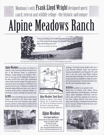
Date: 2003 Title: Alpine Meadow Ranch Flyer
Description: "Montana�s only Frank Lloyd Wright designed guest ranch, retreat and wildlife refuge - the historic and unique Alpine Meadow Ranch... In 1910, Frank Lloyd Wright was commissioned to design a development that would allow people from the city to live in the mountains, pick apples, socialize, and live in a little utopia. It is believed that Wright visited the site to select the locations of the dwellings." (Published by the Alpine Meadow Ranch, Darby, Montana) Includes three photographs and one illustration. 29 copies. For more information on the Como Orchard Summer Colony see our Wright Study.
Size: 8.5 x 11
Pages: Pg 1
ST#: 2003.36.0909
Date: 2005 Title: Alpine Meadow Ranch Brochure
Description: "Montana�s only Frank Lloyd Wright designed guest ranch, retreat and wildlife refuge - the historic and unique Alpine Meadow Guest Ranch, LLC... In 1910, Frank Lloyd Wright was commissioned to design a development that would allow people from the city to live in the mountains, pick apples, socialize, and live in a little utopia. It is believed that Wright visited the site to select the locations of the dwellings." (Published by the Alpine Meadow Guest Ranch, LLC, Darby, Montana) Includes nine photographs and one illustration. For more information on the Como Orchard Summer Colony see our Wright Study.
Size: 3.4 x 7.7
Pages: Pp 6
ST#: 2005.24.0909
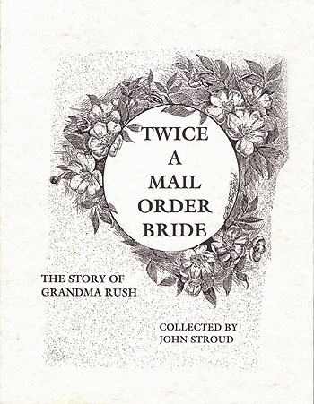
Date: 2006 Title: Twice a Mail Order Bride, The Story of Grandma Rush. (Soft Cover) (Published by Stoneydale Press Publishing Company, Stevensville, MT)
Author: Stroud, John
Description: "This Local History also touches on.. the connection of the Apple Boom to the Bitter Root Inn designed by Frank Lloyd Wright; as well as the irrigation from Lake Como south of Hamilton. Lake Como was named by Father Antonio Ravalli after a lake very similar to this in the Alps of his native Italy." (Publishers description.) Includes information and three images of the Bitter Root Inn designed by Frank Lloyd Wright. Original List Price $13.95. (First Edition) See Additional Information...
Size: 8.5 x 11
Pages: Pp 104
ST#: 2006.27.0909
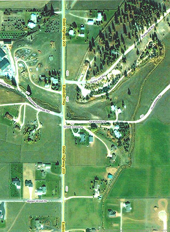
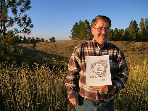
John Stroud hold a copy of his book "Twice a Mail Order Bride" which includes information and three photographic postcards of the Bitter Root Inn. The site of the original Bitter Root Inn is over his left shoulder, across the ravine.Date: 2009 Title: Bitterroot Valley, Montana: Aerial Map.
Description: Aerial view of the site of the Bitter Root Inn (S#145) in 2009. (Published by DigitalGlobe, GeoEye) See Additional Information...
Size: 8.5 x 11
ST#: 2009.05.1009
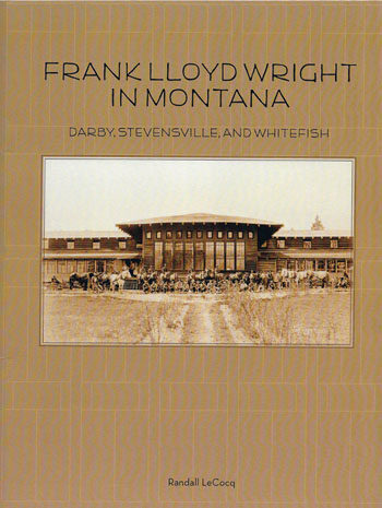
Date: 2013 Title: Frank Lloyd Wright in Montana, Darby, Stevensville and Whitefish (Soft Cover) (Published by Drumlummon, Helena, Montana)
Author: LeCocq, Randall
Description: Publisher�s description: Generously illustrated with photographs and architectural drawings, Frank Lloyd Wright in Montana: Darby, Stevensville, and Whitefish highlights the intriguing stories of three little-known but important Frank Lloyd Wright projects built during the 20th century in western Montana. Randall LeCocq writes: "[Wright�s two] Bitterroot projects, Bitter Root Town and Como Orchard�s "University Heights," remain significant to architectural historians as early examples of architectural modernism... They are models of Wright�s early "Prairie House" designs, few of which are to be found outside of Wright�s core midwestern U.S. homeland. The Bitterroot projects are also significant as early twentieth-century experiments in town planning... providing a community close to nature, where like-minded families could live in "organic," uncluttered houses and cultivate their own ten-acre apple plots. Original list price $9.95. (First Edition)
Size: 8.5 x 11
Pages: Pp 32
ST#: 2013.05.0114
BITTER ROOT INN, NEAR STEVENSVILLE, MONTANA (1908 - S.145)
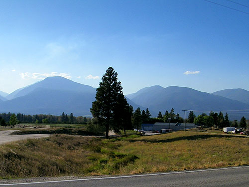
This past summer my wife and I had the opportunity to travel through Montana, so she graciously allowed me a detour through the beautiful Bitterroot Valley in the Southwestern corner of Montana, just a few miles South of Missoula. The goal was two fold. To locate the original site of the Bitter Root Inn, and to document the two remaining buildings designed by Wright in the Como Orchard Summer Colony, University Heights (S.144) in Darby. They were two separate projects, financed by the same company, the Bitter Root Valley Irrigation Company, but are physically over forty miles apart. These two, along with the Lockridge Medical Clinic in Whitefish (S.425) (1958) make up the three Wright projects in Montana.
In preparation for our trip I contacted John Stroud, an author and local historian, born, raised and living in the Stevensville area of the Bitterroot Valley. I met John in town at the local Drug Store, purchased his book and had the opportunity to spend time getting acquainted with the area, stopping to see the historic St. Mary�s Mission and listening to some of the local stories, then headed out to locate the site of the Bitter Root Inn.
Unlike the "cold inhospitable place" discovered by Lewis and Clark in September 1805, I found the Bitterroot valley beautiful and inviting, actually commenting to my wife that this would be a beautiful place to retire. Norman Maclean�s "A River Runs Through It" was written about life during the early twentieth century in Missoula, on the Northern end of the Bitterroot Mountains.
Stevensville was the first permanent settlement in the state of Montana. It was settled by Jesuit Missionaries at the request of the Bitter Root Salish Indians. Through their interactions with the Iroquois between 1812 and 1820, the Salish leaned about Christianity and the Jesuits that worked with Indian tribes teaching them agriculture, medicine, and religion. In 1831, four young Salish men were dispatched to St. Louis to request a "blackrobe". They were directed to William Clark (Lewis and Clark). At that time Clark administered their territory. During their trip two of the Indians died at the home of General Clark. The remaining two met with Bishop Rosati who assured them that missionaries would be sent when funds and missionaries were available. In 1835 and 1837 the Salish dispatched men again. Finally in 1839 a group of Iroquois and Salish met Father DeSmet in Council Bluff, IA. He promised to fulfill their request the following year. He finally arrived two years later in Stevensville on September 24, 1841 and called the settlement St. Mary�s. He immediately built a chapel, then log cabins and Montana�s first pharmacy. In 1850 Major John Owen arrived in the valley and set up camp north of St. Mary�s. He established a trading post and military strong point named Fort Owen, which served the settlers, Indians, and missionaries in the valley. In 1853 territorial Governor Isaac Ingalls Stevens spent time surveying the area as he slowly moved west following the Lewis & Clark�s trail. He was called back to active duty with the Union Army. He was killed in action in 1862 at Chantilly. In 1864 St. Mary's was changed to Stevensville in his honor.
In 1887 Marcus Daly, one of Montana�s "Copper Kings" came to the Bitterroot valley in search of timber for his Butte mines. He built a mill and formed the town of Hamilton. He built a beautiful summer home in 1887 and accumulated over 22,000 acres for timber and for his hobby of breeding and racing thoroughbred horses. He named his ranch the Bitter Root Stock Farm. By 1888 over one million board feet of lumber was milled every week in the Bitterroot valley. The town of Hamilton which was along the route of the Northern Pacific Railway, was incorporated in 1894. Calamity Jane even opened a cafe on Main Street in 1896. By the time Daly passed away in 1900, Hamilton was the commercial center of the Bitterroot Valley and the seat of Ravalli County.
One of Daly�s projects was a canal and ditch system for irrigating his land. It was abandoned after his death. In 1905 Samuel Dinsmore continued the concept and started developing the "Big Ditch", an 80 mile irrigation project from Lake Como (justNorthwest of Darby) to Florence, just north of Stevensville. After running into financial difficulty, it was reorganized with the help of Chicago financiers W. I. Moody, Frederick D. Nichols (1906 - S.118) and others and renamed the Bitterroot District Irrigation Co. By 1904 Moody was General Manager of the Muncie Works, producing Iron and Steel as well as operating Natural Gas Wells. Their offices were in the Rookery Building in Chicago. Wright remodeled the Rookery in 1905 (S.113). Moody visited the Bitterroot Valley in 1905. By 1907 they had purchased and sub-divided large sections of the valley into 10 acre parcels for fruit orchard development. They paid $2.50-$15 per acre and resold "apple orchard tracts" at $400-$1,000 per acre. The company quickly became rich.
By 1909 three rail lines ran to Missoula, Montana, with a connecting spur to the Bitterroot Valley. Land, transportation and water. A perfect combination. Most likely because of Nichols� relationship with Wright and Moody�s knowledge of Wright, he was hired to design two developments. Como Orchard Summer Colony (S.144) and the Town of Bitter Root. In February 1909 Wright, Moody and Nichols visited the valley (FLWNL). Wright's first site plan for the Town of Bitter Root was rejected. His second proposal was a scaled down version which he called the Village of Bitter Root which included the Bitter Root Inn, the only structure built in the Village. It opened in October of 1909. Sales was aimed at the wealthy. The "apple boom" was on. Investors from the east were wined and dined. They were given free rail passage and transportation where they were lavishly entertained at the Bitter Root Inn. Lodging, dinner and golf were free. So was the French wine.
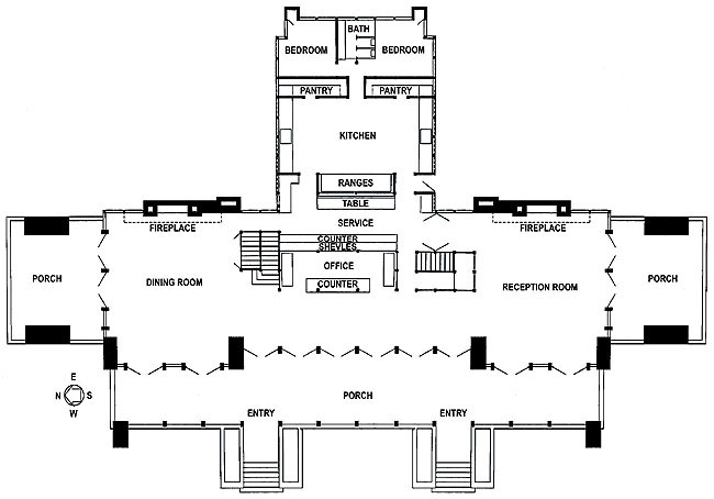
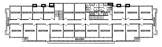
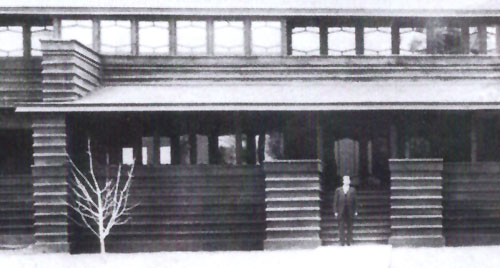
There were many classic Prairie styled Wright details in the Bitter Root Inn, a paradise in the wilderness. The basic material was wood, using board and batten siding and shingles for the roof. Strong horizontal lines, low-pitched roof, broad overhanging eaves, horizontal rows of leaded or mullion divided glass windows and glass doors, two prominent centrally located fireplaces and chimneys, balconies and porches. The Dining and Reception Rooms were designed with large semicircular fireplaces. There are built-in piers or columns that could have been designed for planters or large vases like many of his buildings at that time. The drawings for the unbuilt Office in Bitter Root did include large vases. The Inn was 126 feet long and two stories tall. The first floor included a Dining Room on the north, an office in the center, a Reception Room on the South, and a large Porch on either end. The wing behind the center office included a kitchen and two additional bedrooms. An open gallery ran the length of the front of the building. The second floor included 20 Bedrooms, Men�s and Women�s Baths in center and Balconies on either end. Running water and electricity included.
The boom was short lived. Blight destroyed much of the valley�s crop in 1913. Law suits plagued the company. They filed for bankruptcy in 1916. It ceased as an inn, but was used as a dance hall and roadhouse. Finally on July 26, 1924, fire destroyed the Bitter Root Inn.
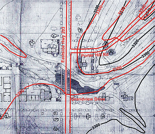
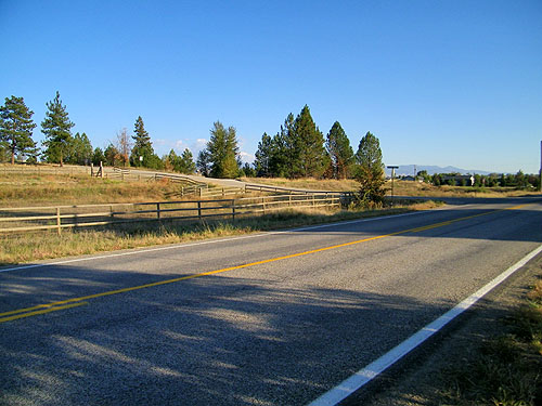
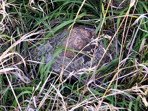
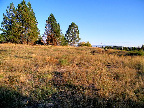
Wright�s second site plan for the Village of Bitter Root, which included the Inn, also include typographical markings. When matching those to existing maps, Porter Hill Road now runs through the North end of the site of the Bitter Root Inn. Little remains of the "dreams" of Bitter Root, Montana one day overtaking Missoula in size and importance. A cursory glance would reveal little of the few remnants of the original concrete foundation. The original Northwest corner property marker exists, though it can�t be confirmed it wasn�t moved over the years. About 150 yards to the North a single fire hydrant is all that remains of the town�s water system and power plant installed one hundred years ago. Dreams change, memories fade, time passes, life goes one. But if not for the dreams of Moody, Nichols and Wright, the Bitter Root Inn would never have been conceived and built.
Text by Douglas M. Steiner, Copyright September 2009.Fort Owen 1853 Isaac Ingalls Stevens Rookery Building Locating Bitter Root Inn Site
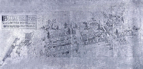
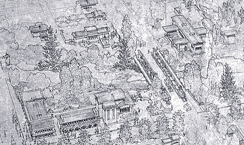
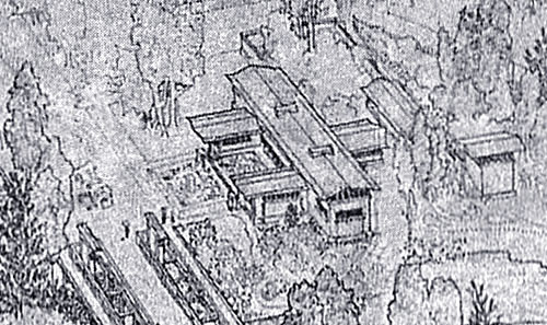
Site Plan for the Town of Bitter Root Site Plan for the Village of Bitter Root Birds-eye View of Bitter Root Village
Original Floor Plan Bitter Root Inn Circa 1910 Bitter Root Inn Circa 1915 View From Bitter Root Circa 1915
Photographs of the Site of the Original Bitter Root Inn Books & Articles Additional Wright Studies
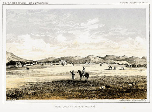
Fort Owen, Bitterroot Valley, Montana, September 1853 Fort Owen - Flathead Village. U.S.P.R.R. Exp. & Surveys - 47th & 49th Parallels. General Report - Plate XXX. Stanley, Del. Sarony Major & Knapp Liths. 449 Broadway, N.Y.
The Stevens expedition, following the Lewis & Clark Trail, arrived at Fort Owens on September 28, 1853. Territorial Governor Isaac Ingle Stevens wrote: "I would earnestly urge all persons desirous to know the minute details of the topography of this valley to study carefully the narrative of Lewis and Clark; for to us it was a matter of the greatest gratification, with their narrative in hand, to pass through this valley and realize the fidelity and the graphic character of their descriptions." Published in "Reports of Explorations and Surveys to Ascertain the Most Practicable and Economical Route for a Railroad from the Mississippi River to the Pacific Ocean." Made under the direction of the Secretary of War in 1853-5. Volume XII, Book I. Washington: Thomas H. Ford, Printer 1860. Illustrated by John Mix Stanley.Isaac Ingalls Stevens
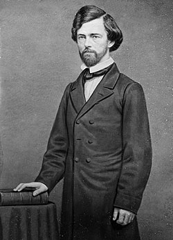
Honorable Isaac Ingalls Stevens. First Governor of he newly created Washington Territory which included Washington, Idaho, parts of Montana and Nebraska. Circa 1855-1860. Courtesy Library of Congress.
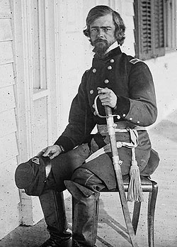
General Isaac Ingalls Stevens.
Photographed March 1862 in Beaufort, S.C. by Timothy H. O'Sullivan shortly before his death. Courtesy Library of Congress.
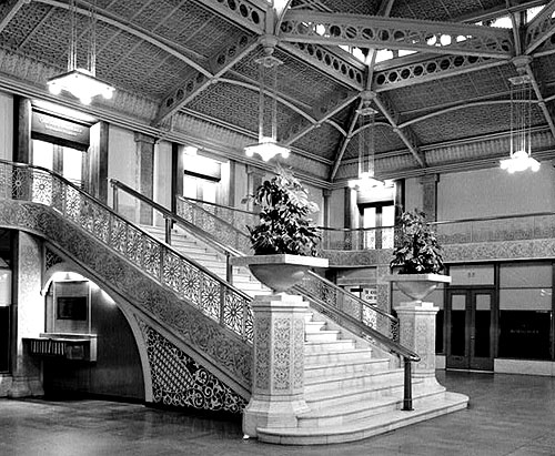
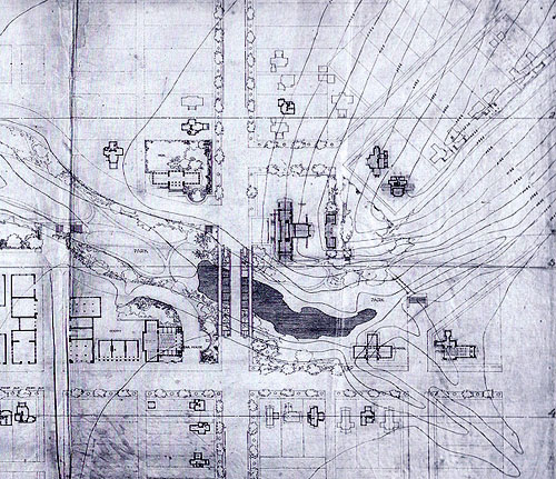
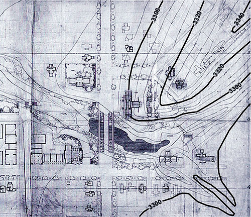
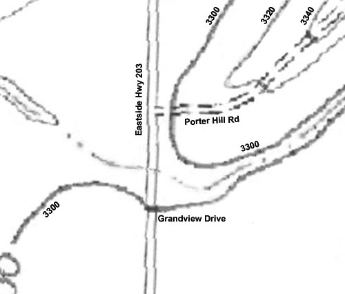
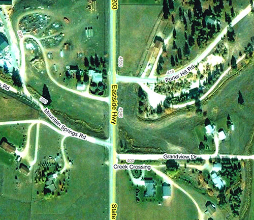
Rookery Building 1905 (S.113) By 1904, W. I. Moody was General Manager of the Muncie Works, producing Iron and Steel as well as operating Natural Gas Wells. Their offices were in the Rookery Building in Chicago. Wright remodeled the Rookery in 1905 (S.113). Locating Bitter Root Inn Site Detail of the Site plan laid out in 1909 by Frank Lloyd Wright, which included topographic measurements. Courtesy of The Frank Lloyd Wright Foundation. Detail of the Site plan laid out in 1909 by Frank Lloyd Wright, with enhanced topographic labeling added by Douglas Steiner. Detail of the USGS topographic map 2009. Enhanced topographic labeling added by Douglas Steiner. John Stroud indicated that some excavation has taken place on the hillside over the years. Courtesy of the USGS. Detail of the Site plan laid out in 1909 by Frank Lloyd Wright, overlaid with 2009 topographic map (red). John Stroud indicated that some excavation has taken place, which may account for variations between 1909 and 2009, but give a clear indication as to where the Inn was located. Aerial view of the site in 2009. Courtesy of DigitalGlobe, GeoEye.
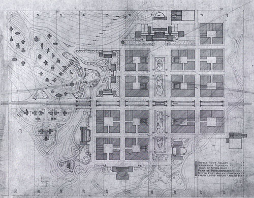
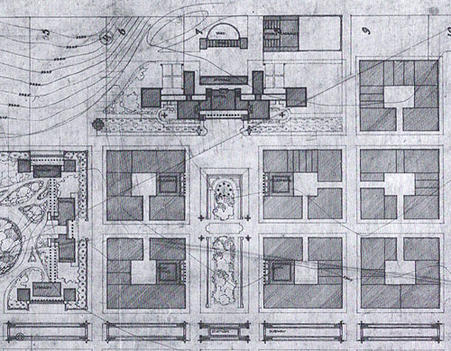
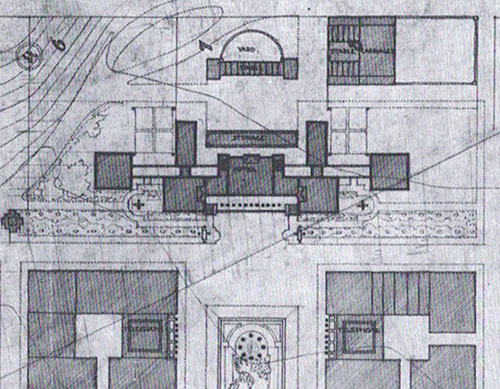
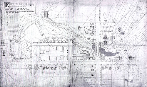
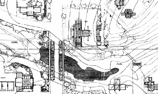
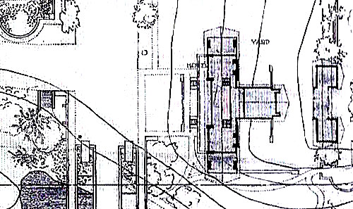
Site Plan for the Town of Bitter Root Wright's first site plan for the Town of Bitter Root included a Hotel, top center, with a planted pedestrian boulevard that ran westerly from the hotel through the middle of town. Running North and South through the middle of town was the rail line which Wright envisioned as a Subway, with a station in the center. Wright included a School and Library, top left corner of town, the Administration Offices lower left of town and a Theater, bottom center. The Hospital was just to the right, and the Light and Power Company was on the far right. The buildings in town were designed with open center courts. The Fire Department, Telegraph Office and other services were dispersed in these buildings throughout the town. This first site plan for the Town of Bitter Root was rejected and Wright proposal s a scaled down version he called the Village of Bitter Root. Courtesy of The Frank Lloyd Wright Foundation. This detail includes the Hotel, top center, with a planted pedestrian boulevard that ran westerly from the hotel through the middle of town. Running North and South through the middle of town was the rail line which Wright envisioned as a Subway, with a station in the center. Wright included a School and Library, seen on the left. The buildings in town were designed with open center courts. The Fire Department, Telegraph Office and other services were dispersed in these buildings throughout the town. The Hotel Wright proposed for the Town of Bitter Root was much larger than the Inn that was finally realized. It was extensively landscaped, and included storage, stables and a garage for carriages. Site Plan for the Village of Bitter Root Wright's first site plan for the Town of Bitter Root was rejected. His second proposal was a scaled down version which he called the Village of Bitter Root. It included a Train Station on the left, Market Buildings with an open Court in the center, an Opera House and across the stream and ravine on the right, the Bitter Root Inn. The Inn was the only structure built in the Village. Courtesy of The Frank Lloyd Wright Foundation. Detail of Wright's second site plan for the Village of Bitter Root. It included a Library at the top left, a Park in the center left in the Ravine and the Opera House at the bottom left. The Bridge is in the center. Note the interesting design. The Bitter Root Inn (Hotel) is in the center. At the bottom right, a School is the second building from the right and a Church on the far right. Detail of Wright's second site plan for the Village of Bitter Root. The Bitter Root Inn, labeled Hotel, is in the center. Birds-eye View of the Village of Bitter Root Birds-eye view of Wright's proposal plan for the Village of Bitter Root. It included a Train Station on the left, Market Buildings with an open Court in the center, an Opera House and across the stream and ravine on the right, the Bitter Root Inn. The Inn was the only structure built in the Village. Courtesy of The Frank Lloyd Wright Foundation. Detail of the Birds-eye view for the Village of Bitter Root. It included a Library left of center, near the top left, and the Opera House at the bottom center, the taller building. The Bridge is in the center. Note the interesting design. The Bitter Root Inn is near the top right. Detail of the Birds-eye view for the Bitter Root Inn. Drawing of the Inn show that the two wings off he front of the Inn were erased, indicating that he intended to include them in the first designed. They could have been removed to cut costs.
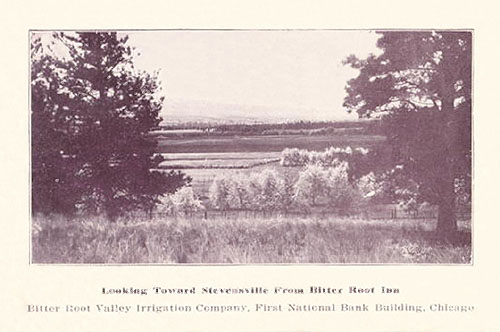
Original Floor Plan The Inn was 126 feet long, two stories tall and built on a 3.5 foot grid. The first floor included a Dining Room on the north, an office in the center, a Reception Room on the South and a large Porch on either end. The wing behind the center office included a kitchen and two additional bedrooms. A open gallery ran the length of the front of the building. The second floor included 20 Bedrooms, Men�s and Women�s Baths in center and Balconies on either end. Running water and electricity included. The second floor was 120 feet long and included 20 Bedrooms. The Men�s and Women�s Baths were in center and Balconies on either end and one that ran partially across the front. Running water and electricity were included. Planter boxes were in the front, to the left and right side of the balcony. Original floor plan copyright 1993, �The Frank Lloyd Wright Companion� Storrer, William Allin, page 148. Modified by Douglas M. Steiner, copyright 2009. Bitter Root Inn, Circa 1910 There were many classic Prairie styled Wright details in the Bitter Root Inn, a paradise in the wilderness. The basic material was wood, using board and batten siding and shingles for the roof. Strong horizontal lines, low-pitched roof, broad overhanging eaves, horizontal rows of leaded or mullion divided glass windows and glass doors, two prominent centrally located fireplaces and chimneys, balconies and porches. The Dining and Reception Rooms were designed with large semicircular fireplaces. There are built-in piers or columns that could have been designed for planters or large vases like many of his buildings at that time. The drawings for the unbuilt Office in Bitter Root did include large vases. The Inn was 126 feet long and two stories tall. The first floor included a Dining Room on the left, an office in the center, a Reception Room on the right, and a large Porch on either end. An open gallery ran the length of the front of the building. The second floor included 20 Bedrooms, Men�s and Women�s Baths, and a Balcony that runs along the front and one on either end. Running water and electricity included. Detail shows many of the Wright details in the Bitter Root Inn: Board and batten siding; Rows of leaded or mullion divided glass windows and glass doors. The person standing in front of the stairs shows the size relationship of the pedestals on either side of the stairs. Bitter Root Inn, Circa 1915 The Porch has been enclosed on the end of the first floor. A fence has enclosed the yard, flowers planted and plants added to the pedestals on either side of the stairs. Original fireplug can be seen on the left, just to the right of the pole on the left. View from the Bitter Root Inn, Postcard Circa 1915 "Looking Toward Stevensville From Bitter Root Inn. Bitter Root Valley Irrigation Company, First National Bank Building, Chicago." Photographs of the Original Site for the Bitter Root Inn, September 2009
One of the goals of our detour through the beautiful Bitterroot Valley this past summer was to locate the original site of the Bitter Root Inn. In preparation for our trip I contacted John Stroud, an author and local historian, born, raised and living in the Stevensville area of the Bitterroot Valley. I met John in town at the local Drug Store, purchased his book and had the opportunity to spend time getting acquainted with the area, stopping to see the historic St. Mary�s Mission and listening to some of the local stories, then headed out to locate the site of the Bitter Root Inn.
Unlike the "cold inhospitable place" discovered by Lewis and Clark in September 1805, just a little over two hundred years, I found the Bitterroot valley beautiful and inviting, actually commenting to my wife that this would be a beautiful place to retire. Norman Maclean�s "A River Runs Through It" was written about life during the early twentieth century in Missoula, on the Northern end of the Bitterroot Mountains.
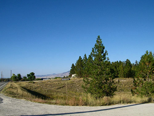
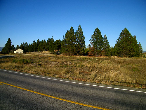
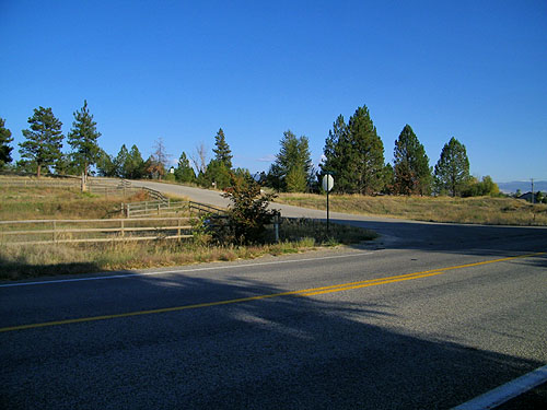
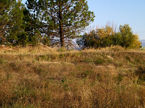
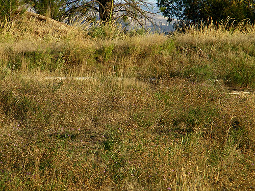
When we arrived we parked on Grandview Drive, at the South end of the ravine. Where Wright proposed a bridge, dirt and blacktop sit. A small stream stills meanders along the floor of the ravine, and Wright pictured a small pond and park for thecommunity. We decided to head North first, before examining the site. Little remains of the "dreams" of the Village of Bitter Root, Montana one day overtaking Missoula in size and importance. A cursory glance as we walked North along Eastside Highway reveal little of the few remnants of the original concrete foundation. One neighbor we spoke to, who had lived there for years was unaware this was the site of the original Bitter Root Inn. About 150 yards to the North of Porter Hill Road, a single fire hydrant is all that remains of the town�s water system and power plant installed one hundred years ago.
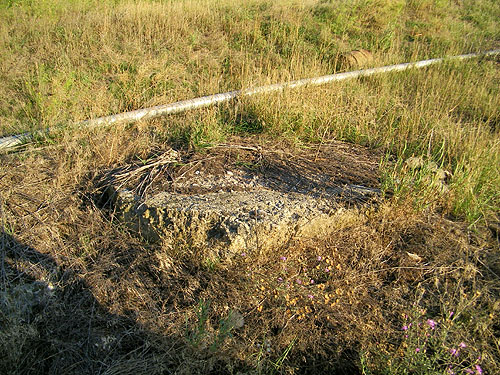
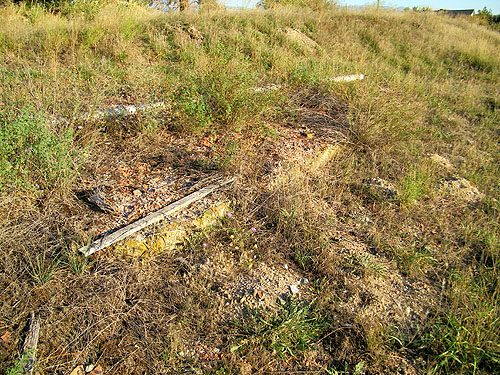
We headed back toward the site and John pointed out an original historic corner property marker located on the Northeast corner of Porter Hill Road and Eastside Highway. Whether this is the original Northwest corner marker for the site of the Bitter Root Inn, can only be confirmed with more research. Large sections of concrete remain on the site. Possibly footings for the fireplace. Dreams change, memories fade, time passes, life goes one. But if not for the dreams of Moody, Nichols and Wright, the Bitter Root Inn would never have been conceived and built.
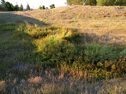
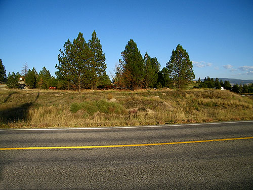
1: Viewed from the South looking past the ravine. When we arrived we parked on Grandview Drive, at the South end of the ravine. Where Wright proposed a bridge, dirt and blacktop sit. A small stream stills meanders along the floor of the ravine. Wright pictured a small pond on the East side of the bridge and community park in the ravine on the West side. We decided to head North first, before examining the site. 2: Viewed from the South looking into the ravine. A small stream stills meanders along the floor of the ravine. Wright pictured a small pond here on the East side of the bridge. 3: Viewed from the West looking into the ravine from where Wright envisioned a bridge. A small stream stills meanders along the floor of the ravine. Wright pictured a small pond here on the East side of the bridge
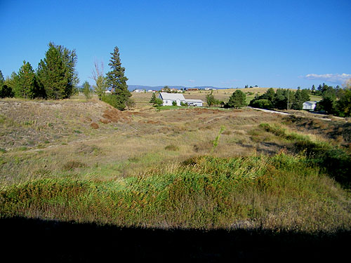
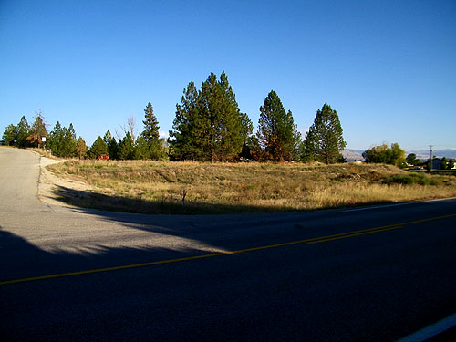
4: Viewed from the East looking into the ravine from where Wright envisioned a bridge. A small stream stills meanders along the floor of the ravine. Wright pictured a community park in the ravine on this west side of the bridge. 5: View of the site from the Southwest. Little remains of the "dreams" of the Village of Bitter Root Inn. A cursory glance as we walked North along Eastside Highway reveal little of the few remnants of the original concrete foundation. One neighbor we spoke to, who had lived there for years was unaware this was the site of the original Bitter Root Inn. 6: View of the site from the West. A cursory glance as we walked North along Eastside Highway reveal little of the few remnants of the original concrete foundation. Approximate position of where the next photograph (6b)was take around 1910. 6b: Bitter Root Inn circa 1910. 7: View of the site from the Northwest. Approximate position of where the next photograph (7b) was take around 1915.
7b: Bitter Root Inn circa 1910. 8: View of the site from the Northwest. Porter Hill Road is on the left. 9: View of the site as we headed North of Porter Hill Road, toward the fire hydrant that remains from the town�s water system and power plant installed one hundred years ago. 10: View of the site from the North. 11: John Stroud located the fire hydrant that is a remnant of the town�s water system and power plant installed one hundred years ago. 12: About 150 yards to the North of Porter Hill Road, a single fire hydrant is all that remains of the town�s water system and power plant installed one hundred years ago. 13: We headed back toward the site and John pointed out an original historic corner property marker located on the Northeast corner of Porter Hill Road and Eastside Highway just in front of the large concrete block. 14: The original historic corner property marker is located just in front of the large concrete block. Whether this is the original Northwest corner marker for the site of the Bitter Root Inn, can only be confirmed with more research. 15: A cursory glance of the site reveal little of the few remnants of the original concrete foundation. Just below the tree line we located large sections of concrete. Possibly footings for the fireplace. 16: Just below the tree line there are large sections of concrete. Possibly footings for the fireplace. 17: The large sections of concrete are just in front of the long plastic pipe and the 2x4 on the right. 18: We located a large number of large sections of concrete. 19: This section of concrete, just in front of the 2x4 was almost completely buried. 20: John hold a small piece of concrete next to a section of concrete, an artifact of the Bitter Root Inn to be added to our collection. 21: John Stroud hold a copy of his book "Twice a Mail Order Bride" which includes information and three photographic postcards of the Bitter Root Inn. The site is over his left shoulder, across the ravine.
For more information about John's book...
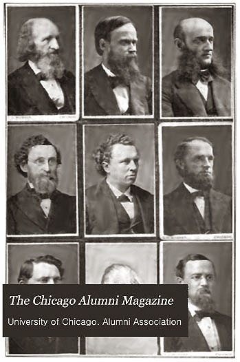
THE CHICAGO ALUMNI MAGAZINE
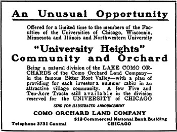
Advertisement: Como Orchard Land Co.
Title: The Chicago Alumni Magazine - March 1908 (Published monthly by The University of Chicago Alumni Association, The University of Chicago, Chicago.)
Author: Advertisement: Como Orchard Land Co.
Description: "An Unusual Opportunity." Half page ad for the Como Orchard Land Co. "University Heights, Community and Orchard... with a plan of providing for each investor a summer cabin in an attractive village community. A few Five and Ten-Acre Tracts still available in he division reserved for the University of Chicago..." Related to the Como Orchard Summer Colony (S.144). Original cover price 25c. For more information on the Como Orchard Summer Colony see our Wright Study.
Size: 9 x 6.5. Digital copy.
Pages: P 21
S#: 0085.07.1109
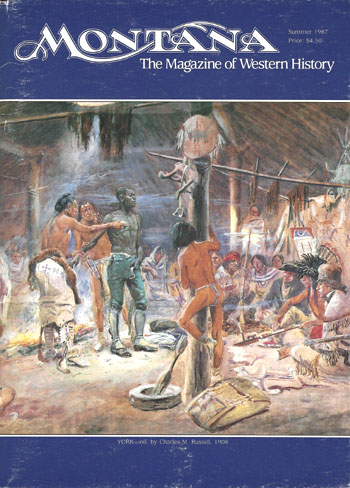
MONTANA, THE MAGAZINE OF WESTERN HISTORY Date: 1987 Title: Montana, The Magazine of Western History - Summer 1987 (Published quarterly by the Montana Historical Society, Helena, MT)
Author: Johnson, Donald Johnson
Description: "Frank Lloyd Wright�s Architectural Projects in the Bitterroot Valley, 1909-1910... Frank Lloyd Wright was invited to participate in this optimistic enterprise. His role was that of architect and community planner for BRVICo, and he began the first project in the Bitterroot Valley in early 1909 with a plan for University Heights, a subdivision development to be located near Darby. Wright�s success with that commission encouraged BRVICo to ask him to design the new city of Bitter Root, six miles north of Stevensville near a main lateral of the Big Ditch." Includes 12 photographs and illustrations. Original cover price $4.50.
Size: 7.75 x 10.75
Pages: Pp 12 - 25
ST#: 1987.83.1014
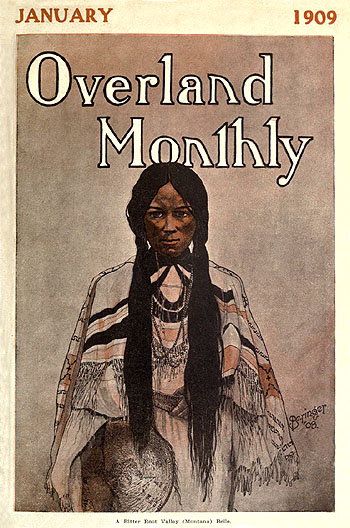
OVERLAND MONTHLY Date: January 1909 Title: Overland Monthly - January 1909 (Published monthly by The Overland Monthly Company, San Francisco, CA and Butte, Montana)
Author: Teale, George M.
Description: "The Bitter Root Valley." Description and information on the Bitter Root Valley. Includes 22 photographs. Includes information on the Bitter Root Valley Irrigation Co. and W.I. Moody. "...and some day the inhabitants will look back to these days and bless the day that the B. R. V. I. Co. was organized." Moody was involved in financing and promoting the Como Orchard Summer Colony, University Heights (S.144) and the Bitter Root Inn (S.145). Original cover price 15c per issue.
Size: 7 x 10.5. (Digital copy)
Pages: Pp 59-69
S#: 0086.01.1009
Additional Wright Studies SEE ADDITIONAL WRIGHT STUDIES Frank Lloyd Wright's First Published Article (1898) Photographic Chronology of Frank Lloyd Wright Portraits Frank Lloyd Wright's Nakoma Clubhouse & Sculptures."
A comprehensive study of Wright�s Nakoma Clubhouse
and the Nakoma and Nakomis Sculptures. Now Available.
Limited Edition. More information.Text copyright Douglas M. Steiner, Copyright 2014, 2025.
BACK TO TOP
HOME ARTIFACTS AUDIO BOOKS PERIODICALS PHOTOS POSTCARDS POSTERS STAMPS STUDIES ASSISTING ABOUT SLIDE SHOW To donate or pass on information, comments or questions:
steinerag@msn.com
©Copyright Douglas M. Steiner, 2001, 2025